Advances in Animal and Veterinary Sciences
Research Article
Adv. Anim. Vet. Sci. 9(10): 1517-1524
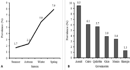
Figure 1
Temporal (A) and Spatial (B) prevalence of Avian influenza (H5N1) virus in different season and different tested governorate in Egypt. Analysis and figures were performed by SPSS software Version 19.0.IBM (SPSS Inc., Chicago, IL, USA).
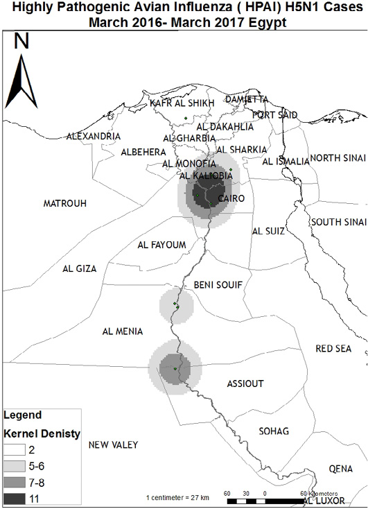
Figure 2
Map for Highly Pathogenic Avian Influenza (HPAI) H5N1 cases “ March 2016-March 2017, Egypt. The Arc GIS software (Geographic Information System) program (ArcMap version 10.1 software) was used to draw a Map with foci of AI infection of the examined poultry along the different governorates. Arc GIS is a computer system is produced by Environmental Systems Research Institute (ESRI) and are used for capturing, storing, checking, and displaying data related to positions on Earth’s surface.


